
A Placemaking Journal
Next Urbanism Lab 05: The Value of Visuals


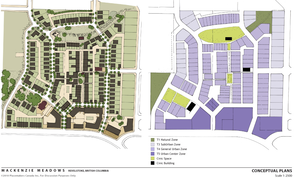
In simple terms, a plan is an adopted statement of policy, in the form of text, maps, and/or graphics, used to guide public and private actions that affect our future built environment. A plan provides decision makers with the information they need to make informed decisions affecting the long-range social, economic, and physical growth of neighborhoods, districts and corridors. Regional, city-wide, neighborhood, and specific area plans usually provide a visual representation of the plan’s objectives and intent.
Last week, Hazel Borys blogged about the need to articulate a local vision. Our most influential plans have also been supported by great visuals.
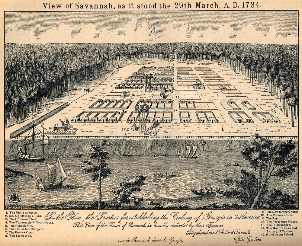
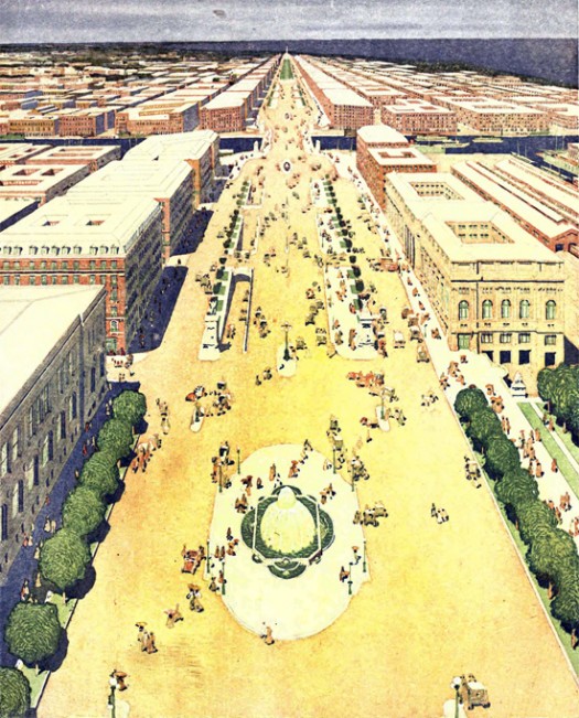
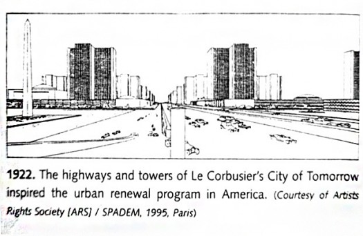
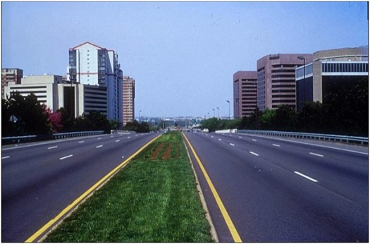
William Penn first advertised the layout of Philadelphia in 1683. In 1733, General James E. Oglethorpe founded Savannah, Georgia, and created a very distinctive city plan that planner and resident Kevin Klinkenberg has studied extensively. And, Daniel Burnham made no small plan(s) for Chicago in 1906. Even Le Corbusier’s 1926 vision of Towers in a Park were compellingly conveyed by simple line drawings ushering in a modernist era… one ultimately realized across our nation.
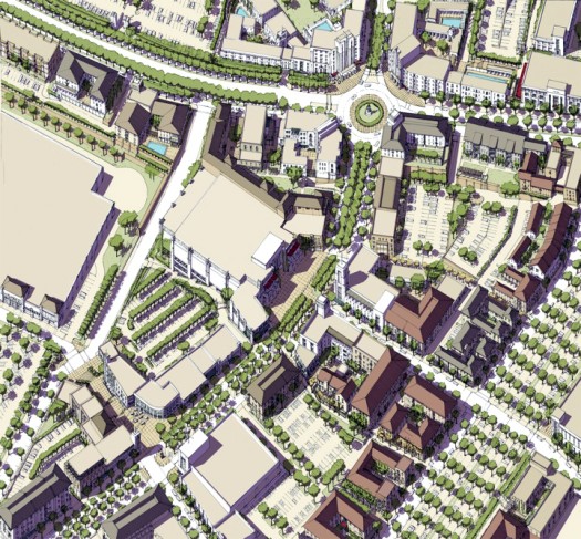
That tradition of crafting great visuals to convey great ideas has, through New Urban placemaking endeavors and the form-based regulating plans that codify them, been resurrected. Our illustrations now range from photo visual simulations to exacting line drawings to charming watercolors. As tastes change over time, the timelessness of great visuals remains.
For example, last November the citizens of El Paso successfully passed a neighborhood-focussed Quality-of-Life bond with an amazing 70% voter approval because it was linked to a visually compelling Vision Plan led by Dover, Kohl & Partners. Meanwhile, San Diego’s brilliant City of Villages policy plan sits in stasis for lack of any visual maps, graphics or illustrations to build long-term political will.
The point is, while plans may provide decision-makers with information, they also provide a politician’s constituents the ability to envision an unknown, and thereby risky, future. As John Nolen eloquently wrote in San Diego’s 1926 Comprehensive Plan, “City Planning is: #1) An aid to the man in the street to visualize his city properly planned.”
Today, the men (and women) in the street are the ones increasingly driving policy change. Where will all that placeshaking take us without compelling visualizations of unifying physical outcomes?
–Howard Blackson

If PlaceShakers is our soapbox, our Facebook page is where we step down, grab a drink and enjoy a little conversation. Looking for a heads-up on the latest community-building news and perspective from around the web? Click through and “Like” us and we’ll keep you in the loop.
